

NATIONAL HISTORICAL PARK
Pullman National Historical Park, Chicago, IL
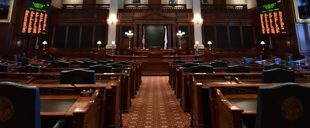
Pullman National Historical Park (originally Pullman National Monument) was designated by President Barack Obama on February 19, 2015, making it the first National Park Service unit in Chicago. The park tells the story of one of the first planned industrial communities in the United States, the sleeping car magnate who helped create it, and the workers who lived there. The district is significant for its influence on urban planning and design, as well as its role in American labor history, including the 1894 Pullman Strike and Boycott.
Located in what is now the Pullman neighborhood of Chicago, the historic district includes the site of the former Pullman Palace Car Works shops and administration building, the Hotel Florence (named after George Pullman's eldest child), Arcade Park, and the Greenstone Church (currently the Greenstone United Methodist Church). Also within the district is the A. Philip Randolph Pullman Porter Museum, named for the prominent leader A. Philip Randolph, which recognizes and explores African American labor history.
There are many places to explore at Pullman National Historical Park. Start at the Administration-Clock Tower Building which hosts the Pullman Visitor Center where you can grab a self-guided tour, view exhibits, and learn more about what you'll see in the Historical Park. Throughout the neighborhood, you will find a variety of different historic homes and buildings. Visit Market Hall, Pullman Firehouse and the Pullman Wheelhouse,
You can also visit partners across the Park boundaries:
Historic Pullman Foundation our official friends groupNational A. Philip Randolph Pullman Porter Museum (Temporarily closed)
NATIONAL HISTORIC SITES
Lincoln Home, Springfield, IL
Abraham Lincoln believed in the ideal that everyone in America should have the opportunity to improve their economic and social condition. Lincoln’s life was the embodiment of that idea. We know him as the sixteenth president but he was also a spouse, parent, and neighbor who experienced the same hopes, dreams, and challenges of life that are still experienced by many people today.
The home where Lincoln spent 17 years before becoming president is surrounded by a 4-block area that has been carefully restored. The park offers visitors the chance to learn about Lincoln, his neighbors, and the time in which they lived.
If you can't make the trip to Springfield, you can take a virtual tour of Abraham Lincoln's home.
Emmett Till and Mamie Till-Mobley National Monument, Chicago, IL.
The Emmett Till and Mamie Till-Mobley National Monument is located in Sumner and Glendora, Mississippi, and Chicago, Illinois.In Illinois, the site of Emmett Till's funeral in 1955, Roberts Temple Church of God in Christ in Chicago’s South Side is part of the National Monument. Since church remains active, public access is limited to the exterior of the building. Visitor information is located at Pullman National Historical Park 11 miles to the south. A Passport to Your National Parks® cancellation stamp for the Illinois unit is available at the Pullman National Historical Park Administration Clock Tower Building Visitor Center.
Learn more at the Emmett Till Memory Project.
New Philadelphia, New Philadelphia, IL
To a casual observer, New Philadelphia looked like a typical Illinois pioneer town. But a closer look revealed a unique and racially diverse community. New Philadelphia was the first US town platted and registered by an African American. A formerly enslaved man, Free Frank McWorter, founded New Philadelphia in 1836 and purchased freedom for himself and 15 family members.
The site became a unit of the National Park Service in December 2022. The National Park Service is working in partnership with community stakeholders and existing site partners to plan the New Philadelphia National Historic Site. During this process, the site will continue to be stewarded and maintained by the New Philadelphia Association.
New Philadelphia is listed in the National Register of Historic Places, designated as a National Historic Landmark, and included in the National Park Service’s National Underground Railroad Network to Freedom. The story of the McWorters and New Philadelphia is included in the Smithsonian National Museum of American History’s ongoing exhibit, “Many Voices, One Nation."
NATIONAL HISTORIC TRAILS
Lewis & Clark National Historic Trail, 16 States
The Lewis and Clark National Historic Trail winds nearly 4,900 miles through the homelands of more than 60 Tribal nations. It follows the historic outbound and inbound routes of the Lewis and Clark Expedition of 1803-1806 from Pittsburgh, Pennsylvania to the mouth of the Columbia River, near present day Astoria, Oregon, plus the preparatory routes from Pennsylvania to Wood River, Illinois.
The trail connects 16 states (Pennsylvania, West Virginia, Ohio, Kentucky, Indiana, Illinois, Missouri, Kansas, Iowa, Nebraska, South Dakota, North Dakota, Montana, Idaho, Washington, and Oregon) and many Tribal lands. The trail was established by Congress in 1978 as part of the national trails system (NTS) as one of four original national historic trails and extended by 1,200 miles in 2019. Today, visitors can follow the approximate route of the Corps of Discovery (Lewis and Clark Expedition Members) by exploring the trail using a variety of transportation methods and interpretive means.
Illinois sites along the Lewis & Clark National Historic Trail:
Cahokia Courthouse, Cahokia
Meriwether Lewis and William Clark used Cahokia Courthouse a place to gather information for their journey. All correspondence with President Thomas Jefferson went through the post office at Cahokia.
Mississippi/Missouri Confluence, Hartford
Meeting point of two of the most important rivers systems in the United States.
Winter Camp at Wood River (Camp Dubois), HartfordWinter quarters for the Lewis & Clark expedition 1803-1804
Lewis & Clark Confluence Tower, Hartford
The Lewis & Clark Confluence Tower rises an impressive 150 feet above the confluence of the Mississippi and Missouri rivers. Built to commemorate the 200th anniversary of the beginning of the Lewis & Clark Expedition, construction on the monument was completed on May 14, 2010.
Lewis and Clark Enter into Louisiana Purchase, Cairo
This is the location of the confluence of the Ohio and Mississippi Rivers. Meriwether Lewis and William Clark passed through here in 1803 on their way into lands ceded to the United States from France as part of the Louisiana Purchase.
Cairo Custom House Museum, CairoThe Cairo Custom House was originally used as the location for collecting tariffs on imports being traded along the Mississippi River.Fort Defiance State Park, CairoHere is the land where, in 1803, Lewis and Clark spent time training the other members of the Corps of Discovery how to use their navigational equipment before their journey began.
Fort Kaskaskia, Ellis GroveMeriwether Lewis and William Clark stopped at Fort Kaskaskia in 1803 and recruited new expedition members here.Fort Massac, Metropolis
Meriwether Lewis and William Clark recruited three members of their expedition, Joseph Whitehouse, George Drouillard, and John Newman, at Fort Massac in 1803.
St. Nicholas Landmark, ChesterThe St. Nicholas Landmark sits just down river from the confluence of the Mississippi and Kaskaskia Rivers, where in 1803, Meriwether Lewis, William Clark and their party camped on Horse Island.
Chester Welcome Center, ChesterThe Chester Welcome Center is located adjacent to the Chester Bridge on a bluff above the Mississippi River. A Lewis and Clark marker with history about their voyage of discovery is located on the grounds.
Piney Creek Ravine, Campbell HillWhen Lewis and Clark traveled through Illinois they came upon the Piney Creak Ravines which was a land of wilderness and lush forests. Piney Creek Ravine is now a198 acre nature preserve.
Mormon Pioneer National Historic Trail, IL, IA, NE, UT, WY
Explore the Mormon Pioneer National Historic Trail across five states to see the 1,300-mile route traveled by Mormons who fled Nauvoo, Illinois, to the Great Salt Lake Valley in 1846-1847.
The Mormon Pioneer National Historic Trail was designated by Congress in 1978 and is administered by the National Park Service as a component of the National Trails System. This historic trail commemorates the 1846-47 journey of the Mormon people from Nauvoo, Illinois to the Valley of the Great Salt Lake. The designated corridor is almost 1,300 miles long and the land it runs through is managed by private, state, local, federal, and nonprofit landowners. Trail sites are in private, municipal, tribal, federal, or state ownership. Please ask for permission before visiting any trail sites on private lands and check with public sites for visiting hours and regulations.
Illinois sites along the Mormon Pioneer National Historic Trail:
Carthage Jail, CarthageThe Carthage Jail was the site of the murder of Joseph Smith, the founder of the Church of Latter-day Saints, and his brother Hyrum at the hands of an armed mob in June of 1844.
Nauvoo National Historic District, Nauvoo
In 1839, Joseph Smith and his faithful fled Missouri, whose governor had ordered the Latter-day Saints to leave or be exterminated. They found refuge in Illinois, where an advance group of Saints had prepared a new town site. There, in a horseshoe bend of the Mississippi River, they built Nauvoo, the new home of the Church of Christ of Latter-day Saints.
This site contains 1,100 acres of authentically restored homes and shops, including Brigham Young's home. The historic district in the town of Nauvoo contains 18 restored houses, shops, and a visitor center.
Trail Of Tears, AL, AR, GA, IL, KY, MO, NC, OK, TN
Remember and commemorate the survival of the Cherokee people, forcefully removed from their homelands in Georgia, Alabama, and Tennessee to live in Indian Territory, now Oklahoma. They traveled by foot, horse, wagon, or steamboat in 1838-1839.
Illinois sites along the Trail of Tears National Historic Trail:
Hamburg Hill, Jonesboro
The trail on Hamburg Hill follows a remnant of the road traveled by Cherokee detachments during the forced removal of 1838-1839. Today, visitors can retrace a one mile segment of trail swale, hiking through this deep road-cut.
Cherokees passed through Southern Illinois between November, 1838, and January, 1839, on the Trail of Tears. Cherokees crossed the Ohio River into Illinois at Golconda.
McCorkle Creek, Vienna
McCorkle Creek, at the East side of Vienna, Illinois, was a camping site in 1838 for those traveling on the Trail. The land owner, Mr. Joseph McCorkle, gave the Cherokee permission to camp there.
NATIONAL FOREST
Shawnee National Forest, Shawnee Hills of Southern Illinois
Nestled in southern Illinois between the Ohio and Mississippi rivers, the Shawnee National Forest spans 289,000 acres featuring oak-hickory forests, flourishing wetlands, grassy openlands, lush canyons, sheer bluffs and unique geological features.
President Franklin D. Roosevelt declared the lands to be the Shawnee National Forest in September 1939. Most of the land added to the Forest in its first decade of existence was exhausted farmland. Throughout the 1930s and 1940s, the Civilian Conservation Corps planted pine trees to prevent erosion and help rebuild the soil. However, the Forest is also home to many hardwood trees and other plant and animal species characteristic of the region.
Recreation Areas to visit in the Shawnee National Forest:
Bell Smith Springs’ distinct plant communities and geological features make it a National Natural Landmark. Here, you will find a variety of habitats for plants and wildlife. Birders come from across America to find tanagers, sparrows, pileated woodpeckers, eastern phoebes and several different species of vireos. The canyons and wooded slopes provide habitat for more than 700 species of flowering plants, ferns and lichens.
Shawnee Hills took millions of years to form. Rock formations and cliffs at Garden of the Gods — made of sandstone — are about 320 million years old. Observation Trail is a quarter-mile-long interpretive trail that leads to areas on top of the bluffs, which feature views of Shawnee Hills and Garden of the Gods Wilderness. You can see rock formations with names such as Camel Rock, Table Rock and Devil’s Smokestack.
Pounds Hollow campground and lake are tucked away among the Shawnee Hills. At 25 acres, Pounds Hollow Lake is large enough to provide visitors seclusion during their visit. This day-use area offers swimming, picnicking, fishing, boating and hiking.
Surrounded by tall pine trees and mixed hardwood forests, Lake Glendale Recreation Area offers a wide range of recreation opportunities including, hiking, camping, swimming, boating and fishing.
Located on a quiet, northwest finger of Kinkaid Lake, Johnson Creek Recreation Area offers a variety of outdoor activities, from camping and boating to hiking along the lake and biking the scenic roads.
NATIONAL HISTORIC LANDMARKS
- Robert S. Abbott House, Chicago
- Adler Planetarium - Chicago
- Auditorium Building - Chicago
- Bishop Hill Colony - Bishop Hill
- Cahokia Mounds - St. Clair County
- Carson Pirie Scott & Company Store (Sullivan Bldg.), Chicago
- James Charnley House (Charnley-Persky House) - Chicago
- Chicago Board of Trade Building - Chicago
- Church of the Holy Family - Cahokia
- Columbus Park - Chicago
- Arthur Holly Compton House - Chicago,
- Avery Coonley House - Riverside
- Crow Island School - Winnetka
- Susan Lawrence Dana House - Springfield
- David Davis House - Bloomington
- Charles G. Dawes House - Evanston
- John Deere House and Shop - Ogle County
- Oscar Stanton DePriest House - Chicago
- Jean Baptiste Point Du Sable Homesite - Chicago
- Eads Bridge - East St. Louis
- Farm Creek Section - East Peoria Vicinity
- Farnsworth House - Plano
- John Farson House (Pleasant Home) - Oak Park
- Sam and Ruth Van Sickle Ford House - Aurora
- Fort de Chartres - Randolph County
- Fort Sheridan Historic District - Lake County
- Henry Gerber House - Chicago
- John J. Glessner House - Chicago
- Goldenrod Showboat - Kampsville
- Ulysses S. Grant Home - Galena
- Grant Park Stadium (Solider Field) - Chicago
- Grosse Point Lighthouse - Evanston
- Haymarket Martyrs’ Monument - Forest Park
- Hegeler Carus Mansion - LaSalle
- Isidore H. Heller House - Chicago
- Arthur Heurtley House - Oak Park
- Jane Adams Hull House - Chicago
- Illinois and Michigan Canal Locks and Towpath - Will County
- Nicholas Jarrot Mansion - Cahokia
- Kennicott Grove - Glenview
- Kincaid Mounds Site - Massac and Pope Counties
- Leiter II Building - Chicago
- Frank R. Lillie House - Chicago
- Abraham Lincoln Home - Springfield
- Alfred Caldwell (Lincoln Park) Lily Pool - Chicago
- Lincoln Tomb - Springfield
- Vachel Lindsay House - Springfield
- Owen Lovejoy House - Princeton
- Marquette Building - Chicago
- Marshall Field & Company Store - Chicago
- Mazon Creek Fossil Beds - Grundy County
- Pierre Menard House - Randolph County
- Robert A. Millikan House - Chicago
- Modoc Rock Shelter - Randolph County
- Montgomery Ward Company Complex - Chicago
- Morrow Plots, University of Illinois - Urbana
- Nauvoo Historic District - Nauvoo
- New Philadelphia Townsite - Barry
- Old Kaskaskia Village - LaSalle County
- Old Main, Knox College - Galesburg
- Old State Capitol - Springfield
- Old Stone Gate, Chicago Union Stockyards - Chicago
- Orchestra Hall - Chicago
- President Steamboat - St. Elmo
- Principia College Historic District - Elsah
- Reliance Building - Chicago
- Riverside Historic District - Riverside
- Frederick C. Robie House - Chicago
- Rock Island Arsenal - Rock Island
- Rookery Building - Chicago
- Room 405, George Herbert Jones Laboratory, University of Chicago - Chicago
- Sears, Roebuck and Co. - Chicago
- Second Presbyterian Church - Chicago
- Shedd Aquarium - Chicago
- Chicago Pile-1 Site of First Self-Sustaining Nuclear Reaction - Chicago
- South Dearborn Street-Printing House Row North - Chicago
- S. R. Crown Hall - Chicago
- Starved Rock - LaSalle County
- Adlai E. Stevenson II Farm - Mettawa
- Lorado Taft Midway Studios - Chicago
- Frederick F. Tomek House - Riverside
- Lyman Trumbull House - Alton
- U-505 (German Submarine) - Chicago
- Unity Temple - Oak Park
- University of Illinois Observatory - Urbana
- The Wayside - Winnetka
- Ida B. Wells-Barnett House - Chicago
- Frances Willard House - Evanston
- Daniel Hale Williams House - Chicago
- Frank Lloyd Wright Home and Studio - Oak Park
- Wrigley Field - Chicago
_______________________________________________________
Rep. Weaver calls for repairs to Bishop Hill Historic Site